April 18, 2014 -- Updated 1924 GMT (0324 HKT)
STORY HIGHLIGHTS
- NEW: Plane said to have deviated from flight plan while inside Vietnamese airspace
- NEW: The jet was equipped with four emergency locator transmitters, source says
- Bluefin-21 covered 42 square miles in four trips
- Analysis of an oil sample shows that it is not aircraft engine oil
(CNN) -- New information has come to light about the path taken by Malaysia Airlines Flight 370 before it disappeared from radar screens on March 8.
The plane deviated from its planned route from Kuala Lumpur to Beijing by turning leftward over water while it was still inside Vietnamese airspace, a senior Malaysian aviation source told CNN's Nic Robertson.
The aircraft then climbed to 39,000 feet, just short of the Boeing 777-200ER's 41,000 feet safe operating limit, and maintained that altitude for about 20 minutes over the Malaysian Peninsula before beginning to descend, the source said.
Investigators have determined that the missing jet was equipped with four emergency locator transmitters, or ELTs, which are designed to transmit a plane's location to an emergency satellite when triggered by a crash or by contact with water, the source added.
The ELTs were at the plane's front door, its rear door, in the fuselage and in the cockpit, said the source, who was puzzled over why they appear either not to have activated or, if they did activate, why they were not picked up by the satellite.



Relatives of the 239 passengers and crew have raised questions about the ELTs with Malaysian authorities, suggesting there were at least three aboard the plane, including two portable units and one fixed device.
Malaysia Airlines would not comment
Malaysia Airlines has declined to answer CNN's questions about the ELTs and other matters. The airline said it could not comment on "any questions that relate to information held by other authorities and/or fall under the jurisdiction of the ongoing investigation. ..."
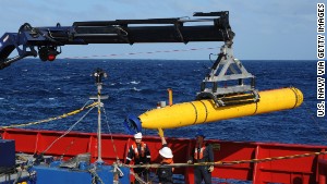
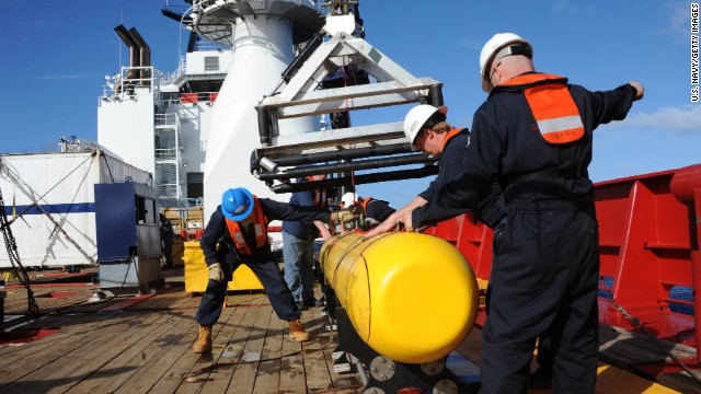
As the details about the investigation emerged, the work of searching for the plane continued Friday, when a drone submerged to the bottom of the Indian Ocean for its sixth trip in search of the missing Malaysian plane.
A fifth mission had been aborted when problems with its inertial navigation system arose, said Michael Dean of the U.S. Navy.
The Bluefin-21 was then re-submerged to resume scanning the floor of the southern Indian Ocean.
During its first four missions, the drone searched about 42 square miles (110 square kilometers). On that fourth mission, it reached a record depth of 15,404 feet (4,695 meters), the Navy said. Pushing that limit "does carry with it some residual risk to the equipment," which is being monitored closely, it said.
The probe typically can search no deeper than about 14,764 feet (4,500 meters), but Bluefin operators said they could tweak it to reach 16,404 feet (5,000 meters) -- beyond the search area's maximum depth of about 15,100 feet (4,600 meters).
Authorities said the probe had scanned 42 square miles (110 square kilometers) without making any "contacts of interest."
'No debris or aircraft wreckage'
The first four dives discovered "no debris or aircraft wreckage," said Phoenix International Holdings, which owns and operates the equipment under a contract with the U.S. Navy.
A single dive takes 24 hours to complete: two hours to submerge to near the ocean floor, 16 hours to map the seabed, two hours to ascend to the surface and four hours to download the images.
The continuing search efforts came as relatives of the people who were aboard the jetliner when it disappeared from radar nearly six weeks ago pressed for answers.
They have drawn up 26 questions that they want addressed by Malaysian officials, who are to meet with them next week in Beijing. Most of the 239 passengers and crew who were aboard Malaysia Airlines Flight 370 were Chinese.
Among their questions: What's in the flight's log book? Can they review the jet's maintenance records? Can they listen to recordings of the Boeing 777 pilot's conversations with air traffic controllers just before contact was lost?


Malaysia's acting transport minister, Hishammuddin Hussein, has defended his government's handling of the operation and accused members of the news media of focusing on the Chinese families. He said relatives of passengers and crew from other nations represented have not had problems.
"The most difficult part of any investigation of this nature is having to deal with the families," he said.
More underwater probes?
Hishammuddin tweeted Friday that authorities are looking at deploying more unmanned underwater probes.
Officials might consider searching along a large portion of sea highlighted by a partial digital "handshake" between the jetliner and an Inmarsat PLC satellite, Dolan said.
That arc of sea is more than 370 miles long and 30 miles wide.
A new setback
Analysis of samples of an oil slick discovered on April 13 and collected 3.4 miles (5.5 kilometers) from where a ping was detected concluded they were neither aircraft engine oil nor hydraulic fluid, Australia's Joint Agency Coordination Centre said Thursday.
Malaysia Airlines Flight 370 vanished on March 8 after taking off from Kuala Lumpur, Malaysia, bound for Beijing.
With no debris found and no possible pings from the plane's "black boxes" detected in more than a week, officials have shifted the focus underwater.
A prolonged undersea search by private contractors could cost a "ballpark rough estimate" of $234 million, said Martin Dolan, Australia's top transport official.
Searches from air and ship may wrap up
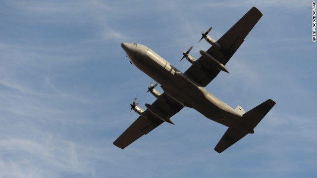
Up to 11 military aircraft and 12 ships were to assist in Friday's search across three areas northwest of Perth, Australia, covering about 20,000 square miles (52,000 square kilometers). But searches from air and ship are probably nearing an end, officials said.
That did not surprise former National Transportation Safety Board Managing Director Peter Goelz. "There's a lot of resources being expended there; it's turned up nothing," he said.
But he predicted the underwater search would continue for the six to eight weeks needed to cover the current search zone. If that turns up nothing, he predicted, towed array sonar probably would be used to search a wider zone.
"This is a very complex operation," ocean search specialist Rob McCallum said. "It's going to be a game of patience now."


No comments:
Post a Comment